
With 2025 coming to a close, we’re taking a moment to highlight the stories and topics that resonated most with our RapidDeploy community. From a life-saving emergency response on I-70 to a breakdown of how to manage emergency response during large, complex events, each of these resources signify how advanced emergency response tools and skilled telecommunicators are transforming public safety for the better.
Join us in revisiting RapidDeploy’s top 15 most impactful and popular resources of the year!
What it’s about: In March 2025, a near-zero visibility dust storm on I-70 in Kansas led to a devastating pileup, creating confusion and testing the limits of emergency response. This blog honors the four Sherman County Communications telecommunicators who received our RapidDeploy Superstar Award for their heroic actions during the incident. The team was honored with their awards at Kansas APCO, celebrating their quick-thinking and ability to stay calm and precise in the midst of chaos.
Why it matters: Technology is only as powerful as the hands that use it. This story is a reminder that while advanced tools enhance emergency response strategies, it is the skill and intelligence of the telecommunicator that ultimately helps save lives. The Superstar Award was created to ensure these behind-the-scenes heroes receive the recognition they deserve, from both their peers and the communities they protect.
What it’s about: Emergency response doesn't end in the call center. This product overview provides an in-depth look at the Lightning mobile app, designed to extend essential Next Generation 911 (NG911) data directly to field responders. Lightning puts life-saving data directly into your team's hands. With real-time alerts and shared incident boards, everyone stays on the same page using the devices they already carry.
Why it matters: When field responders have instant access to location accuracy and caller data, they arrive on the scene better prepared. By placing key 911 data in a first responder's fingertips, we eliminate the information gap that often occurs between telecommunicators and the scene itself. Lightning empowers responders with the situational awareness they need to make faster, safer, and more informed decisions before they even step out of their vehicles, bringing us one step closer to our mission of saving lives.
What it’s about: Morgan County made history as the first PSAP in the state of Indiana to adopt Radius Mapping, and the results were immediate. Within just eight hours of going live, telecommunicators utilized RapidLocate and the breadcrumb features within the Radius Mapping platform to pinpoint and capture a hit-and-run suspect in under 10 minutes. This instant success has earned RapidDeploy a 100% approval rating from the Morgan County team.
Why it matters: New technology often comes with a steep learning curve, but Morgan County Public Safety Dispatch proved that the right tools can deliver life-saving results on day one. By successfully navigating a fast-paced scenario just hours after implementation, they’ve become a blueprint for how PSAPs can seamlessly transition to NG911 technology without missing a beat, transforming new tools into actionable results immediately.
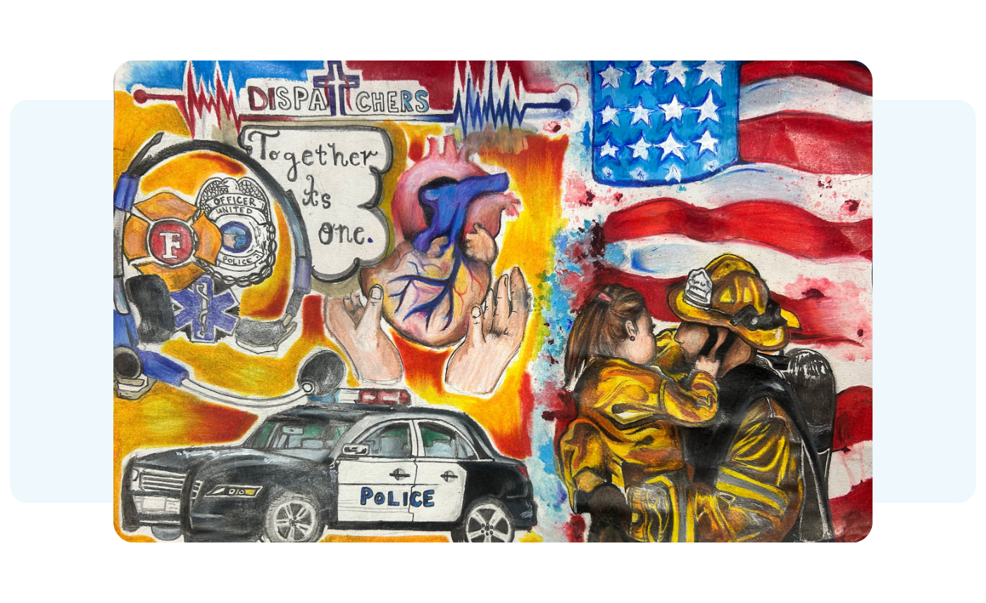
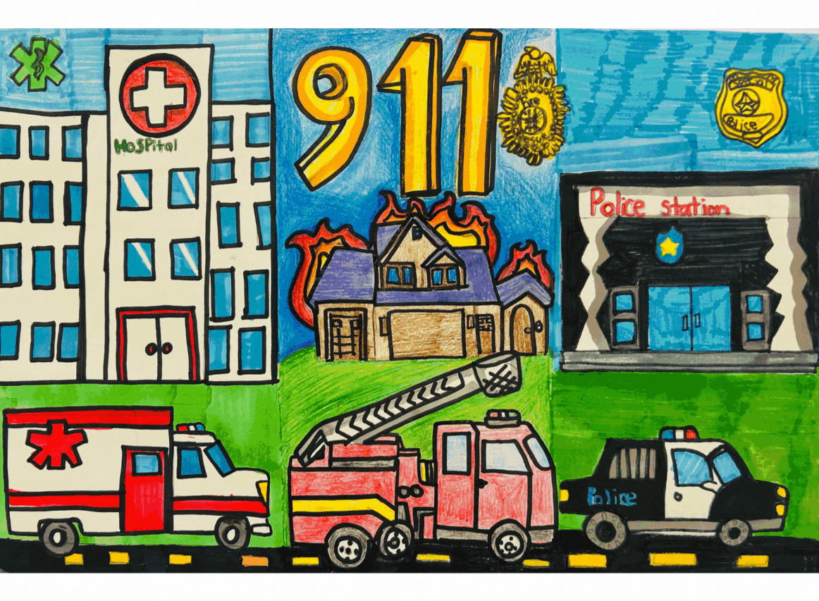
What it’s about: To celebrate National First Responders Day, RapidDeploy partnered with North Central Texas 9-1-1 (NCT9-1-1) for our second annual 911 Heroes Art Contest. We invited K-12 students across Central Texas to create original artwork depicting the courage of first responders and telecommunicators. With over 600 submissions this year, the community came together to vote on their favorites, turning a creative competition into a massive display of public support.
Why it matters: Seeing the work of 911 through the eyes of the next generation is a powerful reminder of the impact these heroes have on our communities. Beyond the contest, these entries have a lasting legacy. The winning pieces will be transformed into public murals in 2026, serving as a lasting tribute to our 911 heroes. Other artworks have been featured in coloring books and earned students scholarships for their future careers. It’s a small way we can give back to those who give everything for our safety.
What it’s about: This moving video captures the moment Wendy Doran, a telecommunicator in Sullivan County, Tennessee, was honored with RapidDeploy’s Superstar Award for her extraordinary response to an infant in distress. When Wendy received a call from a frantic father explaining that his 7-month-old baby was unresponsive, she used RapidVideo to look past the panic and see the situation for herself. By providing a calm, visual connection, she guided the father through life-saving instructions while waiting for first responders to arrive on the scene.
Why it matters: The Superstar Award recognizes that it’s the person wearing the headset—and their courage to lead through a crisis—that actually makes the difference. This recognition highlights how telecommunicators are the "first" first responders. Wendy’s story serves as a powerful reminder that when we equip skilled professionals with the right tools, we can empower public safety leaders to take decisive action.
What it’s about: When Valley Emergency Communications Center (VECC) in Arizona received a call about a residential porch fire, instead of relying on guesswork and immediately deploying all resources to the scene, the telecommunicator launched RapidVideo with the caller, which gave telecommunicators and first responders a real-time visual of the scene, allowing them to confirm immediately that the fire had been contained.
Why it matters: Visual clarity directly translates to smarter resource management. In this instance, having virtual eyes on the scene allowed the agency to scale back the response from seven emergency vehicles to just one. By optimizing resource allocation, RapidVideo ensured that first responders stay safe and that valuable equipment and personnel remained available for other critical calls in the community.
What it’s about: Michele Abbott, Coordinator for Kansas 911, shares the story of how Kansas became the first state to adopt RapidDeploy’s fully integrated product suite. By unifying Radius Mapping, Lightning, and Eclipse Analytics into one cohesive workflow, the state has achieved a new standard of situational awareness. From rural counties to major urban areas, this transition has drastically improved how calls are handled and how first responders are protected in the field.
Why it matters: The true power of NG911 is apparent when data flows seamlessly across the entire emergency response process. With the full suite, Kansas has connected the dots by turning raw data into live maps that actually help responders make better decisions on the move. This “all-in” approach serves as a roadmap for how states can leverage unified technology to drive smarter, faster, and more coordinated outcomes.
What it’s about: The public safety landscape is evolving at a rapid pace. This Ebook provides a comprehensive deep dive into the 2025 innovations that redefined the industry. From cross-agency interoperability and AI-driven insights to the latest in school safety and community empowerment tools, it’s a curated guide to the technologies that transitioned from useful to mission-critical this year.
Why it matters: To lead a modern agency, you have to stay ahead of the technology curve. Understanding these emerging trends empowers your team with the most effective tools available. When agencies and first responders are better prepared, they can act confidently knowing they are backed by the best technology in the field.
For a look at the upcoming technological advancements and public safety trends that are set to make an impact in 2026, download our newest Ebook, The Future of Emergency Response: How NG911, AI, and Emerging Technologies are Shaping the Future of 911.

What it’s about: Josh Michaelis, Director of Rice County Emergency Communications in Kansas shares how Radius Mapping’s Map Markups feature has become a game-changer for rural response. Map Markups has been used by Rice County during bird flu outbreaks and sudden road closures, which allows agencies to draw directly on the map, instantly sharing local knowledge that traditional GIS data might miss.
Why it matters: In rural areas where environments change quickly, static maps can get stale very quickly. Map Markups bridges the gap between the comms center and the field, allowing for real-time updates that keep every responder in the loop. By turning local insights into shared intelligence, this feature ensures that first responders aren't walking into a situation blind, significantly increasing safety and operational speed when it matters most.
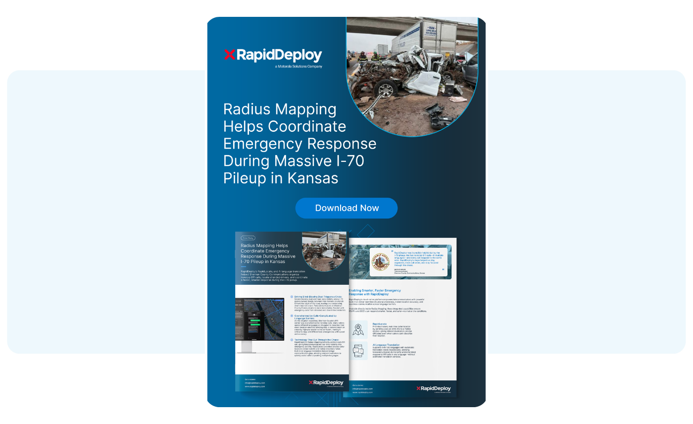
What it’s about: When an abrupt sand storm swept across I-70 in Northern Kansas, hundreds of highway travelers were blinded, leading to a fatal pileup that required an all-hands-on-deck approach by telecommunicators and first responders. With several motorists unable to describe their locations and many non-English speakers, the situation went from difficult to nearly impossible in a matter of minutes. The team at Sherman County Communications promptly launched RapidDeploy’s Radius Mapping platform and used features like RapidLocate and AI translation to quickly cut through the noise and bring first responders directly to callers safely.
Why it matters: High-stakes incidents are often difficult to manage due to a surplus of information that is easily lost in translation or location. This story demonstrates the critical role of NG911 tools in managing large-scale disasters. Powered by Radius Mapping, this massive incident resulted in an organized and fast-paced response, helping save countless lives along the way. Sherman County Communications provided a masterclass in how technology can help telecommunicators maintain control over a chaotic scene.
What it’s about: As the U.S. prepares to host massive global events, like the FIFA World Cup in 2026, a critical gap in public safety infrastructure has surfaced: many 911 systems struggle to process calls from international phone numbers. This blog post explores the "silent emergency" that occurs when international callers cannot be geolocated or called back, and how language barriers further complicate these large-scale interactions.
Why it matters: With hundreds of thousands of international visitors expected in the U.S. in coming years, Emergency Communication Centers (ECCs) must be prepared for more than just localized emergencies. With Radius Mapping, telecommunicators can mitigate this risk by providing precise location data for international devices and instant AI translation.
What it’s about: After being submerged in water, a 911 caller’s 7-month-old baby was left unresponsive. With no time to waste, a Sullivan County telecommunicator acted quickly and launched a one-way, secure RapidVideo call to better assess the infant’s condition. This visual connection allowed for precise, real-time life-saving coaching that kept the child’s passageway clear during the critical gap before EMS arrived on the scene.
Why it matters: Technology like RapidVideo redefines the arrival of help. Traditionally, life-saving interventions began when first responders arrived on the scene. Now, they begin the moment a secure video link is established. This story highlights how visual data removes the ambiguity of a caller’s relaying of information, allowing telecommunicators to deliver life-saving solutions that can be the difference between life and death.
What it’s about: While 911 systems are dependable, they are not immune to failure. This whitepaper provides a strategic roadmap for navigating the risks and impacts of system outages and how advanced technology like RapidDeploy’s can remain reliable and maintain operational continuity and real-time visibility during complex emergency situations.
Why it matters: Widespread outages, natural disasters, and disruptions are unpredictable and bound to happen. When ECCs are better prepared and equipped with innovative technology, they are empowered to enhance resiliency and continue answering calls regardless of obstacles along the way. This resource offers the technical framework needed to build a resilient, continuous response system that stays online when the community needs it most.
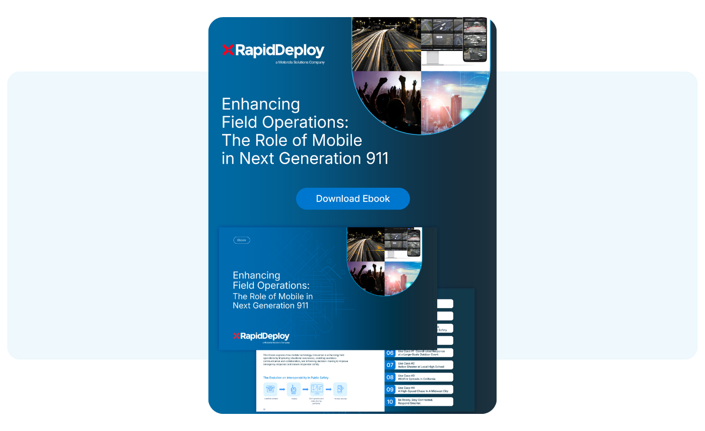
What it’s about: We are witnessing a fundamental shift in the future of emergency response as public safety data moves beyond the call center. This Ebook explores the critical transition to mobile-first awareness, powered by RapidDeploy’s cloud-native product suite. It dives into how innovations like the Lightning mobile app are empowering field responders with the same data previously only available to telecommunicators, ensuring a unified, rapid response from the first ring to the final unit on scene.
Why it matters: In the field, every second counts. By putting real-time mapping and caller data directly into a responder's hand, we eliminate communication barriers and enhance situational awareness for everyone involved. This advancement ensures that first responders have the most up-to-date information at their fingertips, creating a safer, more unified environment for both citizens and the heroes who protect them.
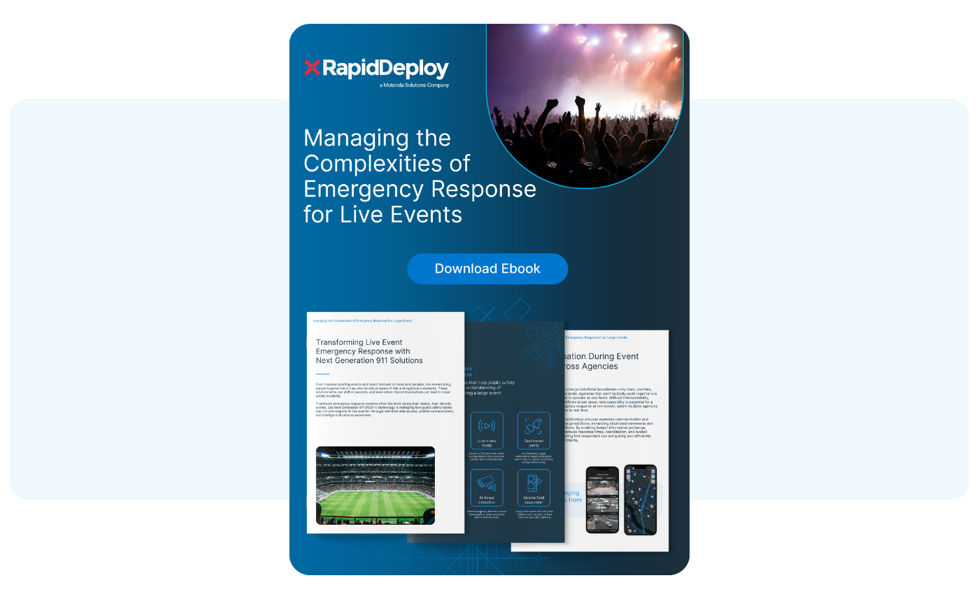
What it’s about: Large-scale events bring high-stakes risks that test the limits of even the most experienced public safety agencies and first responders. This Ebook dives into the unique multitude of challenges in modern event management, from managing massive crowds and communication breakdowns to protecting thousands of international visitors. It provides a practical toolkit of best practices for navigating the chaotic environment of live events with precision and control.
Why it matters: As our most-downloaded resource of 2025, it is clear that public safety leaders are prioritizing a more proactive approach to event safety. This Ebook provides the strategic framework needed to transform a high-stress incident into a coordinated, data-driven response. By addressing critical factors like first responder safety and multi-jurisdictional coordination, this Ebook empowers teams to deliver a safer experience for their communities and a more effective strategy for the field.
From technical deep-dives to stories of frontline heroism, these 15 picks defined a landmark year for the RapidDeploy community. As technology continues to evolve, so does our commitment to those who use it to help save lives. We are proud to stand alongside you as we transition into 2026 with a shared goal: a faster, smarter, and more unified emergency response.
Thank you for the work that you do daily and for allowing RapidDeploy to be a part of your public safety community. Together, we are transforming emergency response.

For many, the first snowfall of the season evokes tranquility. For first responders, however, that same flurry marks the beginning of a winter season in which weather can quickly transform everyday conditions into highly volatile or serious hazards. Obscured road signs, icy roadways, and high-powered winds can emerge, requiring rapid decision making and ongoing situational awareness.
Compounding the onset of winter storms are "extended fire years." Due to climate change, extreme wildfire activity has more than doubled over the past 20 years [NASA] and the fire season is extending beyond the summer. Rising temperatures after dark prevent fires from dying down as they once did, keeping flames active around the clock. The result is a convergence of two unpredictable and dangerous weather forces that threaten civilian safety and strain emergency response systems. Meeting this dual threat requires technology that can quickly adapt to changing conditions.
In the New Year, Next Generation 911 (NG911) technology will be critical to ensure accurate, rapid data is delivered to responders during weather-related emergencies. In this blog, we’ll explore how field responders are leveraging mobile intelligence to make proactive, informed decisions when seconds can make a difference.
Responders cannot control when a wildfire ignites or when a blizzard occurs, but they can control how quickly they arrive, how prepared they are, and how safely they operate. To do so, they need powerful technology to support decision making and speed of response. RapidDeploy's Lightning Mobile App does just this, extending NG911 capabilities directly to the field. Powered by Radius Mapping, Lightning provides law enforcement, fire, EMS, and telecommunicators with a live, shared operating picture and layered intelligence, directly on their devices, that moves with them as conditions evolve. From precise location data to real-time video from the scene, responders gain enhanced situational awareness and seamless interoperability across agencies. Mobile field intelligence has become the foundation of modern day emergency response, ensuring responders arrive prepared, informed, and ready to act.

In a wildfire, a ten-minute delay can mean the difference between a contained brush fire and an uncontrollable blaze. In a winter storm, those same minutes determine whether rescuers reach a stranded motorist before they develop hypothermia. Lightning delivers mission-critical information to responders from the moment the call comes in; precise caller location, incident type, known hazards, and the position of other responding units. By eliminating the time it takes for information to trickle from the Emergency Communications Center (ECC) to the field, Lightning ensures responders know exactly what they're walking into, can select the right equipment, and can plan their approach before they arrive on scene.
When a blizzard obscures visibility or wildfire smoke clouds important landmarks, callers might struggle to describe where they are. Lack of precise location information can quickly become dangerous when seconds matter. Mobile field intelligence eliminates this uncertainty, delivering caller coordinates directly to responders' phones and tablets.
During multi-agency emergencies, knowing the location of responders can be just as critical as the location of callers. Lightning pinpoints where responders are in real-time through both Automatic Vehicle Location (AVL) and mobile device location––whether they're in vehicles or on foot––creating a shared operating picture that shows where active personnel are positioned. If a wildfire changes course or a road closes unexpectedly, teams can strategically allocate resources based on their proximity, or redirect units away from dangerous conditions. This visual coordination reduces communication overhead, streamlines multi-agency operations, and creates safer conditions for responders.
Before NG911, responders heading to an emergency had to piece together critical information from multiple sources: updates from telecommunicators, sourcing building layouts, waiting for information about hazard warnings. In fast-moving weather events where conditions shift in minutes, this fragmented approach costs time and creates information gaps. A firefighter might not know that the wind shifted the fire, putting them in a dangerous position. A patrol officer might attempt to drive through a blocked route, costing valuable time.
Lightning breaks these barriers by consolidating everything into a single, real-time mobile view. Powered by Radius Mapping, the app overlays authoritative GIS data directly onto the operational map, providing layers of intelligence such as aerial imagery, weather patterns, and flood zone information. Field teams can make note of hazards as they develop through Map Markups––flagging road closures, downed power lines, or shifting fire perimeters so everyone can immediately see these updates. When available, indoor floor plans for schools, hospitals, and large buildings integrate seamlessly, giving responders spatial awareness ahead of time.
This unified intelligence eliminates the cognitive burden of juggling multiple systems, accelerates decision making, and strengthens interoperability. During the 2023 Maui wildfires, which destroyed over 2,200 structures [FEMA], Radius Mapping was essential for the team on the ground. Telecommunicator Johnel Davila detailed how Radius Mapping helped them to facilitate communication, track responder locations, and make critical resourcing decisions as conditions changed rapidly. With Lightning, this same level of intelligence is available for responders in the field.
When critical data points such as precise caller location, responder positions, real-time hazards, critical infrastructure, and environmental data come together in one unified view, first responders are able to proactively respond to emergencies and better serve their communities.

During weather emergencies, traditional voice calls don't always tell the complete story. Lightning enables multiple ways to communicate that best serve the caller, responder, and situation.
Live video streaming from cell phones provides immediate visual information about conditions on the ground, revealing important details. A caller might share footage of a fire spreading from campgrounds; a person trapped in their vehicle during a blizzard might show footage of what’s happening outside; someone tending to an injured civilian can show telecommunicators the extent of their injuries. This level of visual intelligence helps responders determine their strategy and enables telecommunicators to guide civilians through immediate survival actions.
Beyond video, text-from-911 has emerged as a critical tool when voice communication is impossible or dangerous. For someone with limited battery life, texting might conserve power while maintaining contact with 911. Additionally, real-time translation capabilities in over 130 languages ensure that language barriers never delay emergency response, allowing all callers to communicate critical information.
By enabling video, text, and translated communication simultaneously, Lightning gives responders unprecedented situational awareness and transforms how public safety responds to the unpredictable nature of weather emergencies.
Next Generation 911 infrastructure, such as Lightning and Radius Mapping, has become a critical foundation for a new wave of transformative technologies that will define the future of emergency response. Built on cloud-native technology, NG911 enables responders to receive texts, photos, and videos, pinpoint caller locations with precision, and connect seamlessly across jurisdictions. But what makes this infrastructure so essential is that it positions agencies to immediately leverage the emerging capabilities arriving now and in the years ahead. For weather emergencies in particular, where conditions evolve rapidly and traditional infrastructure can fail, these tools will mean the difference between a reactive response and one that is proactive–potentially saving lives.
The future of emergency response is at our doorstep. AI systems can analyze 911 calls in real-time, enhance audio quality during thunderous wind, identify critical keywords in distressed calls, and even predict wildfire spread patterns based on incoming data. Drones can now act as first responders, providing aerial intelligence of fire perimeters and flood zones before ground crews arrive, delivering medical supplies to snowbound communities, and giving responders eyes on the scene when roads are impassable. Video analysis will offer unprecedented situational awareness, automatically detecting hazards and guiding resource deployment. Agencies that invest in NG911 infrastructure today position themselves to adopt every advancement as it arrives, ensuring they're ready for tomorrow’s emergencies.
To learn more about how NG911 is shaping the future of emergency response, download our Ebook: The Future of Emergency Response.
As winter storms intensify and wildfires burn almost year-round, these unpredictable forces demand a new standard of emergency response. Mobile intelligence provides that foundation, delivering real-time data, location precision, and unified coordination needed in the face of critical weather conditions. As agencies begin to adopt advanced AI-powered capabilities, responders will be even better prepared to effectively respond to unpredictable situations and ultimately help save more lives.

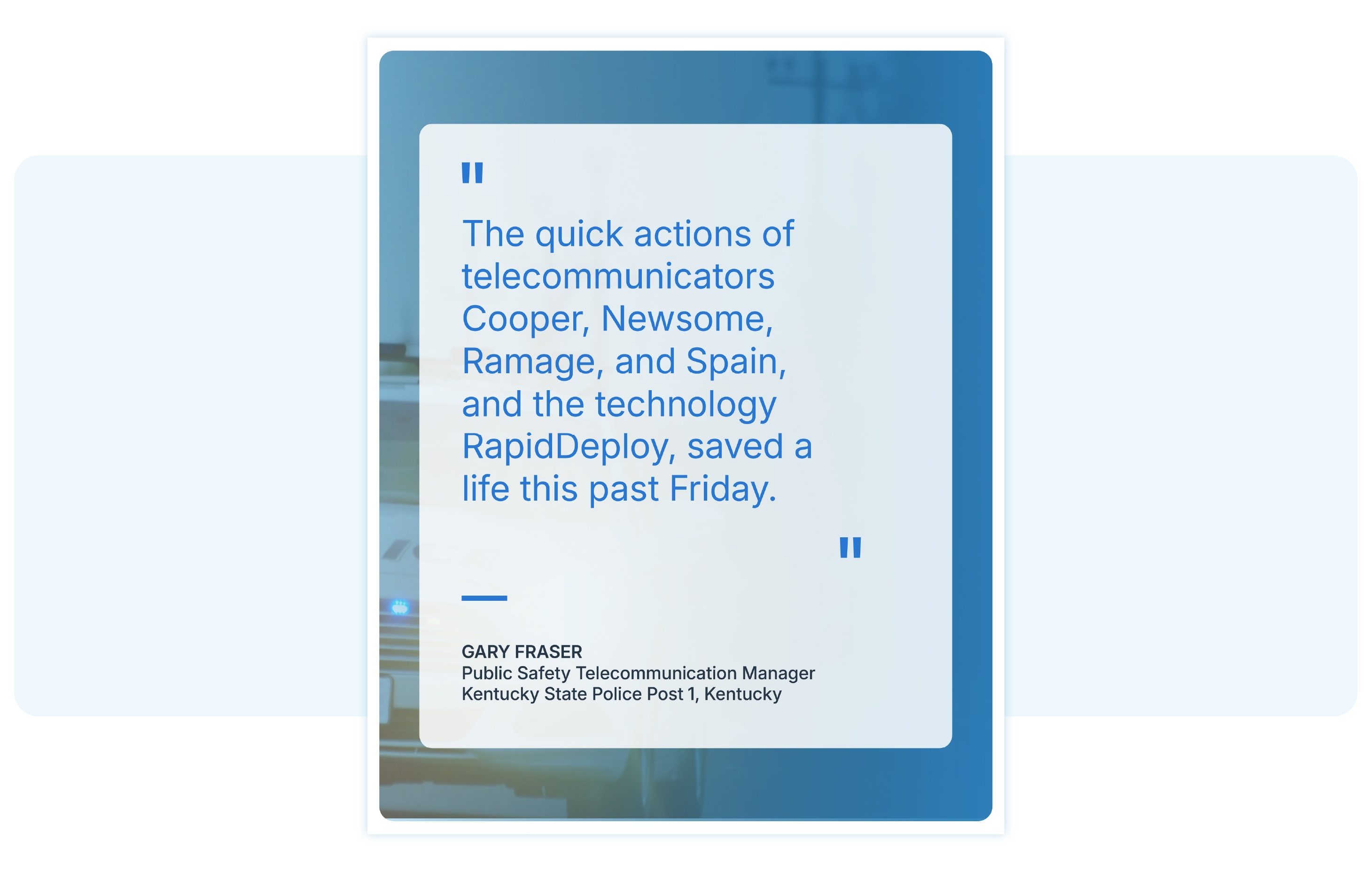
On December 1, 2025, RapidDeploy proudly presented the Q4 2025 RapidDeploy Superstar Award to four outstanding telecommunicators from Kentucky State Police (KSP) Post 1: Alisha Cooper, Kim Newsome, Alaina Ramage, and Chad Spain. This team demonstrated incredible poise, teamwork, and life-saving decision-making during a high-risk domestic violence incident earlier this year.
The RapidDeploy Superstar Award honors telecommunicators who go above and beyond the call of duty, using modern technology and rapid response skills to make a lasting difference when every second counts.

On the morning of March 7, 2025, telecommunicators at KSP Post 1 received multiple 911 calls from the same number. Each time, no sound came through. With no voice to guide them and no immediate location data, the team quickly recognized that this might be more than a misdial.
Recognizing a potentially dangerous situation, they launched a text conversation using their CAD system's text-from-911 capability, which enabled them to communicate with the caller via SMS. Unfortunately, what followed was a chilling back-and-forth that revealed the caller had been physically assaulted and was trapped in a moving vehicle with her assailant. She couldn’t speak out loud because the person who harmed her was sitting beside her in the moving vehicle. Further complicating the situation, her phone’s microphone was broken, and her glasses had been smashed during the assault, making it difficult for her to see street signs or nearby landmarks.
Despite these obstacles, the KSP telecommunicators remained focused, calm, and connected. As the situation unfolded, the caller also revealed she was pregnant and that the man driving had threatened to intentionally crash the car in an attempt to harm her and her unborn child.
Thinking quickly, the team used RapidDeploy’s Radius Mapping to track the movement of the caller in real time, and then used the RapidLocate feature within Radius Mapping to access the caller’s precise GPS data and pinpoint the vehicle’s location, tracking it while it was in motion.
The telecommunicators then relayed key information to nearby law enforcement agencies, including the Fulton County Sheriff’s Department, who were able to stop the vehicle on I-69, just two miles before leaving the state and crossing into the Tennessee state line.
The suspect was taken into custody, and the caller was brought to safety.
“The quick actions of telecommunicators Cooper, Newsome, Ramage, and Spain, and the technology RapidDeploy, saved a life this past Friday.” said Gary Fraser, Public Safety Telecommunication Manager for KSP Post 1
This incident reflects the real-world power of Next Generation 911 (NG911) technology and the crucial role it plays in today’s emergency response centers. Silent calls, mobile emergencies, and rapidly changing situations require tools that go beyond traditional voice-only communication.
With tools like Radius Mapping’s RapidLocate, telecommunicators are empowered to extract life-saving details even when the caller can’t speak. The story from KSP Post 1 is a powerful example of what’s possible when smart technology is combined with expert judgment and teamwork.
If you’re looking to deepen your understanding of how NG911 capabilities help protect callers in complex and time-sensitive situations, explore our guide: Enhance Caller Safety with NextGen 911 Technology.
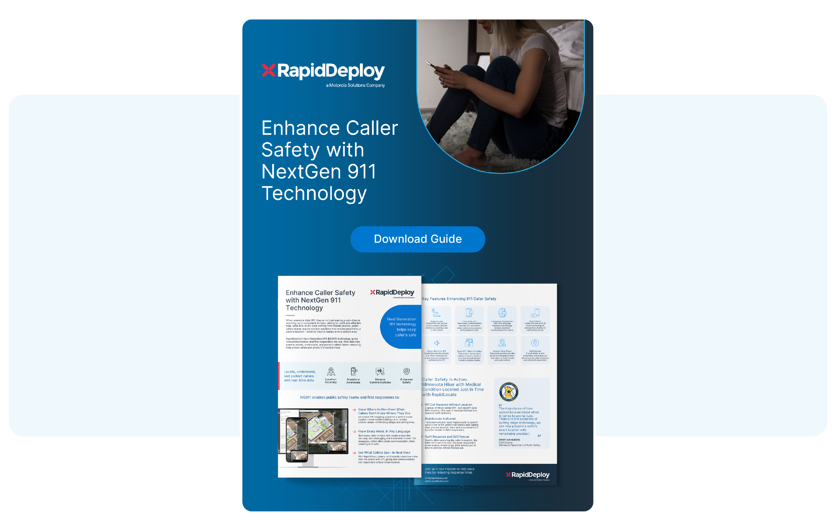
This resource walks through the life-saving capabilities of tools like RapidLocate, RapidVideo, and Smart911 Safety Profiles, showing how each plays a role in reducing response times and enhancing public safety outcomes.
Sadly, the situation the KSP team responded to is not unique. Across the country, there are growing numbers of cases where callers cannot speak freely due to being in the presence of an abuser or a dangerous individual. That’s why features like RapidLocate are essential in modern 911 response.
In a case in Ventura County, California, a 17-year-old human trafficking victim was able to send a text to 911 in Spanish. Using RapidDeploy’s text-to-911 with AI language translation, telecommunicators were able to bridge the language gap, gather key location details, and coordinate a successful rescue, entirely through text.
Download the Ventura County Case Study to learn more about how RapidLocate was used to help rescue this human trafficking victim.

Both the Ventura County, California, and Kentucky stories highlight a critical need in emergency communications: the ability to provide safe, discreet, and reliable ways for callers to connect with help, even when speaking out loud could escalate danger.
We were honored to celebrate the KSP Post 1 team in person on December 1, surrounded by colleagues and leadership who recognize the value of their work. The Superstar Award ceremony is both a moment of recognition and a chance to spotlight the often unseen professionals whose quick thinking and smart use of tools change lives every day.
These four telecommunicators showed what’s possible when technology meets resiliency.
The telecommunicators at Kentucky State Police Post 1–Alisa Cooper, Kim Newsome, Alaina Ramage, and Chad Spain–are a powerful reminder of why we created the RapidDeploy Superstar Award. Their quiet courage, sharp instincts, and use of RapidDeploy technology helped save a woman and her unborn child during a moment of real fear and danger.
Watch the full story told by the telecommunicators in this video below, and see how we celebrated these telecommunicators and the entire team at Kentucky State Police for their life-saving actions.
At RapidDeploy, we created the Superstar Award because these quiet professionals deserve to be seen. Too often, their stories go untold, and potentially every time they pick up the phone, they may need to carry someone’s worst moment. We support and recognize that they need to muster up all of their strength, clarity, and compassion to help someone through their emergency. This matters, and Superstars matter.
We want to celebrate those moments. If you know a telecommunicator who has made a difference, tell us. Help us recognize them in a way that feels right, whether it's nominating someone for a Superstar Award, a team shoutout, or a quiet thank you. If they’re camera shy, that’s okay. We’ll meet them where they are. What matters most is giving them the recognition they deserve from the communities they work so hard to protect.
Nominate a telecommunicator today and help us shine a light on the people who make a difference when every moment matters.

Location data is a cornerstone of effective emergency response. From the instant a 911 call is placed, knowing the caller's location, the precise site of the incident, and the real-time position of every responding resource is critically important. When public safety agencies and all responding teams know exactly where other responders are in relation to an ongoing emergency, resources can be allocated more effectively, tactical decisions can be made more safely, and communication can flow seamlessly across teams and units. A recent study found that having location capabilities for emergency response personnel led to better situational awareness and improved overall response (Globestar).
However, when a field responder is off-duty or on a break, it is important for the emergency communication center to know that a law, fire, or EMS responder is not actively on duty, and therefore they should NOT dispatch the off-duty responder to the scene of the emergency. In this blog post, we’ll explore how Lightning’s new Workforce Status feature supports privacy, gives users control over their visibility to the Emergency Communications Center (ECC), and ensures agencies have accurate data during critical moments that matter.
At the heart of RapidDeploy’s solution is a commitment to unified situational awareness, powered by detailed, precise mapping. The Radius Mapping platform and the field responder-focused Lightning mobile app work together to create a single, shared operating picture. Mission-critical data—such as caller location, points of interest, and responder positions—is consistently visible in both the ECC and on the responder’s mobile device. This cohesive mapping environment allows telecommunicators and field responders to make real-time decisions based on the same, complete view of the emergency.
However, without the ability to give field responders control over their on-duty or off-duty status, a responder’s location could potentially be shared continuously, leading to an inaccurate reflection of their proximity to an event and their ability to respond quickly. To mitigate this, RapidDeploy has introduced Workforce Status. Now available in the Lightning Mobile App, responders can self-select their status with a single tap, choosing between “On Duty”, “On a Break”, or “Off Duty.” Then, this status is used to determine a responder’s visibility on the map; only those responders who are “On Duty” will have their active location information shared with other responders and the dispatch center.

With this added layer of control, agencies can now rely on location data as a true reflection of who is available in the field to respond to an emergency.
Accurate information is central to actionable 911 intelligence. By showing only who is on duty and active on the Radius and Lightning maps, the wider team now knows who is available in the critical moments of an emergency. This capability helps to reduce uncertainty and improve resource coordination, eliminating time that may otherwise be spent tracking down personnel or radioing updates to see who is available.
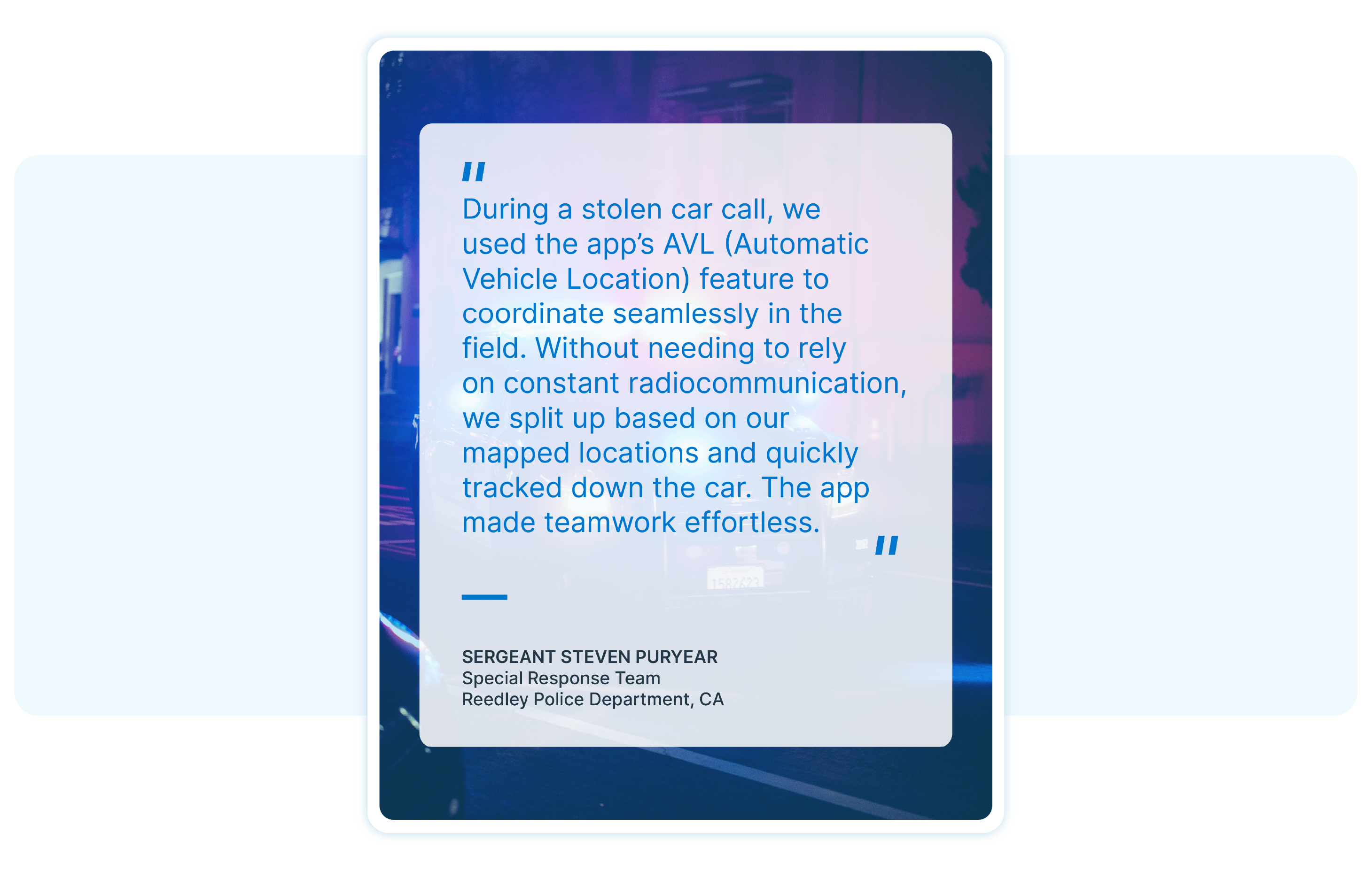
When responders have a transparent view of team locations and resources, they can better manage their response strategy, keep track of officers, and prioritize officer safety. Sergeant Steven Puryear of the Reedley Police Department in California emphasized this when recalling a recent emergency where his team was tracking down a stolen car. Visibility into team locations increased overall collaboration and the speed of their response:
“During a stolen car call, we used the app’s AVL feature to coordinate seamlessly in the field. Without needing to rely on constant radio communication, we split up based on our mapped locations and quickly tracked down the car. The app made teamwork effortless.”
Location accuracy becomes even more important during large-scale or cross-disciplinary incidents, where interagency collaboration and resource planning are critical. Without clear, shared availability statuses of the responding workforces, coordination could slow or even break down.
During the 2023 Maui wildfires, telecommunicator Johnel Davila detailed how vital it was to have Radius Mapping as a resource to facilitate communication, understand where responders were located, and make resourcing decisions.
These real-world stories exemplify how location data strengthens coordination across emergencies, from everyday calls to mass emergencies. When responders can trust that responder location and mapping data reflect the true status of the responders in the field, agencies gain the clarity they need to make faster decisions, reduce response times, and protect both their teams on the frontlines and the communities they serve.
As Next Generation 911 becomes embedded in agency operations and workflows, it’s more important than ever to protect information that is shared. The Workforce Status capability in Lightning helps strengthen this foundation by giving responders the autonomy to manage their own visibility in the field. When responders can self-select when their location is shown, this honors privacy and cultivates trust.
Beyond the right to privacy protection, giving responders more autonomy has been shown to improve morale, strengthen retention, and lead to healthier team dynamics. This is especially true for younger responders entering the workforce who are accustomed to transparency and control over the tools they use. During the COVID-19 pandemic, a mixed-methods study found that when responders have feelings of autonomy at work, there is less turnover and role abandonment (SAGE Journals). Another study found that having control and autonomy helps to minimize the emotional labor experienced when working in post-disaster environments (Brooks et Al., 2018).
Workforce Status in Lightning supports these expectations and helps to create an environment of trust, transparency, and respect. This directly benefits everyone involved: responders know their location is private when they are not active, and telecommunications receive reliable location data that is self-reported and precise. This balance leads to more engaged teams, healthier operational dynamics, and ultimately, better outcomes for the communities they serve.
While accurate location data is essential during the height of fast-moving emergencies, it also plays an important role in resource planning. Over time, a transparent history of responder location gives supervisors a clearer view of how, when, and where teams are deployed, including when resources are unavailable or maxed out. This data can be used to better inform staffing decisions, shift planning, and inform long-term resource strategies to help prevent burnout and support a sustainable workload across employees and agencies.
A clear record of responder availability and location data also strengthens post-emergency reporting. Supervisors can more accurately analyze response timelines, identify points of friction, and refine protocols based on what actually happened. The result is a more accountable, informed, and resilient operational environment that continuously improves with each incident.
As public safety agencies continue to adopt NG911 and data-driven tools, empowering responders with control over their shared location information will be essential. Workforce Status marks an important shift away from top-down systems and gives responders the keys to managing their own availability, privacy, and workflow. For responders, this empowers accountability, protects personal time, and fosters a healthy working environment. For agencies, this means more accurate data, better decision-making, and an accurate reflection of what’s happening in the field.
When responders are working from the same source of truth, coordination becomes smoother and response becomes stronger. Workforce Status is a meaningful step toward that future, giving responders control over their visibility and agencies the clarity they need for safe, effective operations.

67% of parents and teachers are more concerned about school safety now than they were five years ago, according to Motorola’s 2023 School Safety Report. Across the country, schools, legislators, and responders are working hard to build safer environments for students and staff. School districts have created emergency operating plans and routinely implement drills and exercises while innovation in new technology equips responders with critical information to prevent, circumvent, and minimize the impact of emergencies.
While prevention remains the ultimate goal, the reality is that when an emergency does occur, the speed and effectiveness of the response can help save lives. When a 911 call comes in from a school or a panic button from within a school is pushed, it can take telecommunicators time and resources to piece together fragmented information. If outdated systems are in place, this means the telecommunicator needs to organize critical information and determine what is necessary to share with responders, staff, and other stakeholders. Key details such as knowing the precise location of the threat, the number of people involved, and if anyone is harmed could speed up the decision-making process in the field or even change the response strategy. Information gaps and delays cost precious time and can impede critical decisions when every moment matters.
RapidDeploy's Lightning mobile application bridges this gap, delivering Next Generation 911 intelligence directly to field responders' mobile devices in real-time. Critical details such as the caller location, building floor plans, live incident updates, and live camera footage are available in real-time on responders' mobile devices. The result: responders arrive at the scene equipped with a full picture of the emergency and immediate access to evolving information. Real-time, actionable information has become a force multiplier for school emergencies, leading to time saved, improved outcomes, and the potential to help save lives.
In this blog post, we’ll explore how the Lightning mobile application empowers first responders during school emergencies.
School emergencies are inherently complex and fast-moving. The type of emergency incident at a school could range from a false alarm to a need for multi-layered response, such as during a medical crisis, active shooter, or fire. Information is often fast-moving and may come from multiple sources over time. Resources need to be carefully deployed and prioritized, with every decision potentially changing the outcome of the situation at hand.
One of the biggest challenges of a school emergency is pinning down the precise location of the incident. The physical layout of a campus might span several buildings or floors, with different layouts from school to school. More than half of school safety incidents occur in areas such as hallways, parking lots, or sports fields, where visibility is limited and locations are harder to pinpoint (CENTEGIX, 2024). Without advanced technology, responders might arrive on the scene and not know the exact location of the caller, threat, or incident. Precious time might be spent searching buildings, and resources could be deployed ineffectively. Threats can move, injuries might go unattended or people harmed. Having a complete picture of location details is critical to effective response.
Another common challenge for school emergencies is determining the difference between a false alarm and a true emergency. Approximately 90% of bomb threats, for example, turn out to be pranks (Arizona State University). Access to real-time information in the field enables the responding team to escalate or de-escalate the nature of the emergency, potentially saving resources that could be better allocated to different emergencies.
Communication issues compound these challenges. Callers might be unable to speak if they are in imminent danger, making it even more challenging to determine their location without technology tools. Multiple calls could come in at once, each with important details that impact decisions. Ultimately, the time spent parsing critical details and piecing together a full view of the incident could have been spent actively containing the emergency.
In this video, telecommunicators describe an incident at a school in Anderson County, South Carolina, where callers felt unsafe during a school lockdown. The telecommunicators swiftly moved the call to text so students inside the school could communicate without speaking.

RapidDeploy's FirstNet VerifiedTM Lightning mobile app bridges critical information gaps and communication delays by delivering Next Generation 911 intelligence directly to field responders' smartphones and tablets. Powered by Radius Mapping, Lightning extends the capabilities of the ECC into the field, providing officers, firefighters, and EMS personnel with the same real-time data and situational awareness that telecommunicators see on their screens.
Key Features Include:
To ensure seamless coordination without information overload, Lightning intelligently distributes tailored information to responders based on their specific role through a functionality called “Disciplines.” While the location of AEDs might be critical for EMS, for example, police are likely more concerned with optimal access points and positioning. Lightning ensures all agencies arrive with the same foundational intelligence (floor plans, location of callers, live video feeds) but prioritizes information to ensure time is spent effectively. Role-based intelligence mitigates coordination issues and enables a more efficient response by building a common operating picture unique to the incident and responder.
For school emergencies, Lightning has a transformative impact. From pre-arrival intelligence to ongoing situational awareness, instant access to critical information fundamentally shifts the response strategy, saves critical time, and has the potential to save lives.

When responders have access to Lightning, they are equipped with a wealth of pre-arrival intelligence at their fingertips. The more information responders have before arriving on scene, the better prepared they are to make decisions and act quickly. During the critical moments they are en route to a school emergency, dynamic information in Lightning lets responders identify ideal entry points, map out the fastest path to help those in need, and coordinate with other teams in a matter of minutes.
Data Received in Transit Informs:
To maximize pre-intelligence capabilities for first responders and ensure the fastest, most effective response possible, Lightning integrates seamlessly with mission-first, cutting-edge partners who share a relentless focus on making school environments safe::
When seconds can make a difference, responders must arrive prepared and ready to act. From the moment a call is received to arrival on the scene, the flow of information and communication needs to be instantaneous. Lightning makes this possible, leading to more effective decisions, safer operations, and critical seconds saved.
While pre-arrival intelligence helps responders coordinate the initial response strategy, school emergencies rarely remain static. Additional calls come in with new details, incidents move, and the nature of the threat can escalate or de-escalate within minutes. Responders need continuous access to real-time intelligence that adapts as emergencies unfold.
Lightning provides an evolving 360-degree view of school emergencies through a suite of real-time capabilities, including live video streaming, responder tracking, and two-way SMS communication.
Dynamic Intelligence Informs:
This continuous flow of intelligence ensures emergency teams maintain situational awareness throughout the entire incident. Responders are enabled to deploy resources strategically, coordinate with on-site personnel, and adapt their response as conditions change on the ground.
Across industries, access to information and technology levels the playing field. This is also true for emergency response, and in particular for complex scenarios like school emergencies. Delivering equitable response becomes especially challenging when communication barriers exist. Callers may speak a different language, be deaf or hard of hearing. Some callers might be unable to speak during an emergency, whether due to their own health conditions or safety of the environment around them. Lightning's built-in capabilities, including real-time translation and two-way SMS texting, help ensure communication barriers don't compromise response or delay time when responding to a school emergency.
By providing the same level of data, technology, and communication capabilities to every responding unit, Lightning helps create more equitable emergency response within communities that deploy the technology. And with Lightning’s real-time data feeds, responders are enabled to deliver a consistent, coordinated response across the entire district, whether responding to a small elementary school or a large urban campus.
Next Generation 911 is fundamentally changing how responders react when a school emergency unfolds. Lightning optimizes how time is spent from the moment a call comes in to when responders arrive at the scene, ensuring they arrive on campus with comprehensive intelligence. As conditions change and more information trickles in, field responders have immediate access to updates in order to evolve their response. Information is delivered instantly and intelligently in the palm of their hands, with role-based information and tools for seamless coordination.
For schools, this means informed decision-making, a more equitable response, an effective use of resources, and ultimately precious time saved during critical moments. When outcomes can change in mere seconds, Lightning equips field responders with the intelligence they need to protect students and staff.
To learn more about how Lightning can enhance emergency response in your jurisdiction, visit rapiddeploy.com/lightning.

Every year on October 28, National First Responders Day gives us a moment to pause and recognize the people who step forward when others are in need. Firefighters, police officers, paramedics, and 911 telecommunicators are often the first connection in an emergency. They are the calm voice, the steady guide, and the link between crisis and help.
Recently, that recognition took an important step forward. In a historic move, the U.S. Senate unanimously passed the Enhancing First Response Act (S.725), legislation that calls for the reclassification of 911 telecommunicators under the “Protective Service Occupation” category in the federal government’s Standard Occupational Classification system. This aligns with the long-standing goals of the 911 SAVES Act, a bill supported by public safety advocates for years. While this reclassification has not yet been finalized at the federal level, the Senate's action represents a major milestone in recognizing 911 professionals for the critical, life-saving work they do. RapidDeploy applauds this progress and the tireless advocacy from public safety leaders and organizations like NENA and APCO who have helped bring national attention to the role of telecommunicators as essential first responders.
At RapidDeploy, we are proud to support this community through the technology we build and the stories they share. National First Responders Day is not just a date on the calendar for us. It is a chance to reflect on the mission that drives everything we do.
One of the most meaningful ways we celebrate that mission is by lifting up the voices of the next generation.
This fall, we partnered with NCT9-1-1 to host the second annual 911 Heroes Art Contest. This year we expanded the contest to K–12 students across North Central Texas, and invited students to create original artwork honoring first responders in their communities.
We encouraged each artwork representation to include a 911 telecommunicator, or a symbol that represents a telecommunicator or PSAP. Many students chose to include the full spectrum of public safety professionals, including firefighters, EMS personnel, and law enforcement officers.
This year, more than 600 students submitted artwork. Many also recorded short videos describing what inspired their pieces. Their words were thoughtful and honest, reminding us just how clearly young people recognize the importance of those who protect and serve.
In 2024, we were proud to help bring two student-inspired murals to life, each one a celebration of community, creativity, and the people who answer the call.
The first mural was based on the winning artwork from Landrie Reeves, a sixth grader at Stafford Elementary. Her drawing stood out for its heartfelt message and detailed depiction of first responders working together, including fire, EMS, police, and 911 telecommunicators. That piece became the inspiration for a public mural in Italy, Texas, Landrie’s hometown, where it now stands as a personal and powerful tribute to the profession she chose to honor through her art.
The second mural was painted in Bridgeport, Texas, and took shape through a unique collaboration. Students from Miss Dickerson’s art class at Bridgeport Middle School submitted entries as part of the 2024 contest. Several of those submissions were selected and thoughtfully combined into one cohesive design, brought to life by a local muralist. Installed on the historic Bridgeport Hospital building, the mural was unveiled during a community celebration on March 5.
While Landrie’s mural reflected the individual vision of a single young artist, the Bridgeport mural became a collaborative tribute, both honoring first responders in different, but equally meaningful ways.
.png)

We are proud to announce the winner of the 2025 911 Heroes Art Contest:
Selene M., an 8th grader from Dublin Secondary School.
Selene's artwork was selected for its creativity, emotional depth, and a clear message of unity among first responders. It captures the spirit of courage, collaboration, and care that defines emergency response work.
The winning piece will be transformed into a public mural in North Texas, with installation scheduled for 2026. New this year, In recognition of their achievement, the student will also receive a scholarship contribution from Motorola Solutions to support their future education and creative journey.

In addition to the mural winner, we’re thrilled to feature the top 10 entries selected for our special First Responder Coloring Book. These pieces, created by students in grades K–5, will be shared at public safety events and in classrooms across Texas.
Take a look at their incredible work below. Each image celebrates the heroes behind the scenes and on the front lines.

Now in its second year, the 911 Heroes Art Contest brought in dozens of thoughtful and creative submissions from K–12 students across North Central Texas. A panel of judges carefully reviewed the entries and selected ten standout pieces to be featured as finalists in the public voting round.
These works reflect more than just artistic skill. Each one is a personal expression of gratitude, a young person’s way of honoring the people who serve their community in moments of crisis.
From bold colors to intricate detail, these pieces captured the spirit of first response and the heart behind the headset. We’re proud to share this year’s top 10 student tributes below.
Their art reminds us that appreciation can come in many forms, and that first responders leave a lasting impression on even the youngest members of our communities.
This year’s campaign invited something new: spoken gratitude. Alongside their artwork, student artists and children of RapidDeploy and NCT9-1-1 employees were encouraged to share short video messages for the people who show up when it matters most.
What was captured is simple, personal, and moving.
The 911 Heroes Art Contest began as a way to celebrate first responders and engage the next generation through creativity and community. Over the past two years, we’ve seen just how powerful that connection can be: from mural dedications and classroom participation, to heartfelt messages from young artists who are already showing us what gratitude looks like.
We often talk about NextGen 911 as a leap in technology with a future built on data, speed, and smarter tools. But this campaign reminded us that the next generation is already stepping up to support public safety with creativity, compassion, and a deep appreciation for the people who serve.
While this program began in partnership with NCT9-1-1, we believe it could serve as a model for other communities looking to recognize and celebrate their own first responders in meaningful ways.
If your agency, school district, or community is interested in learning more or exploring a potential partnership, we’d love to hear from you.
You can reach us through our contact form.
To every student who submitted artwork, to the teachers and families who encouraged them, and to the first responders who continue to inspire all of us, thank you.
Your service is seen. Your impact is felt. Your work matters.
From all of us at RapidDeploy, happy National First Responders Day.


