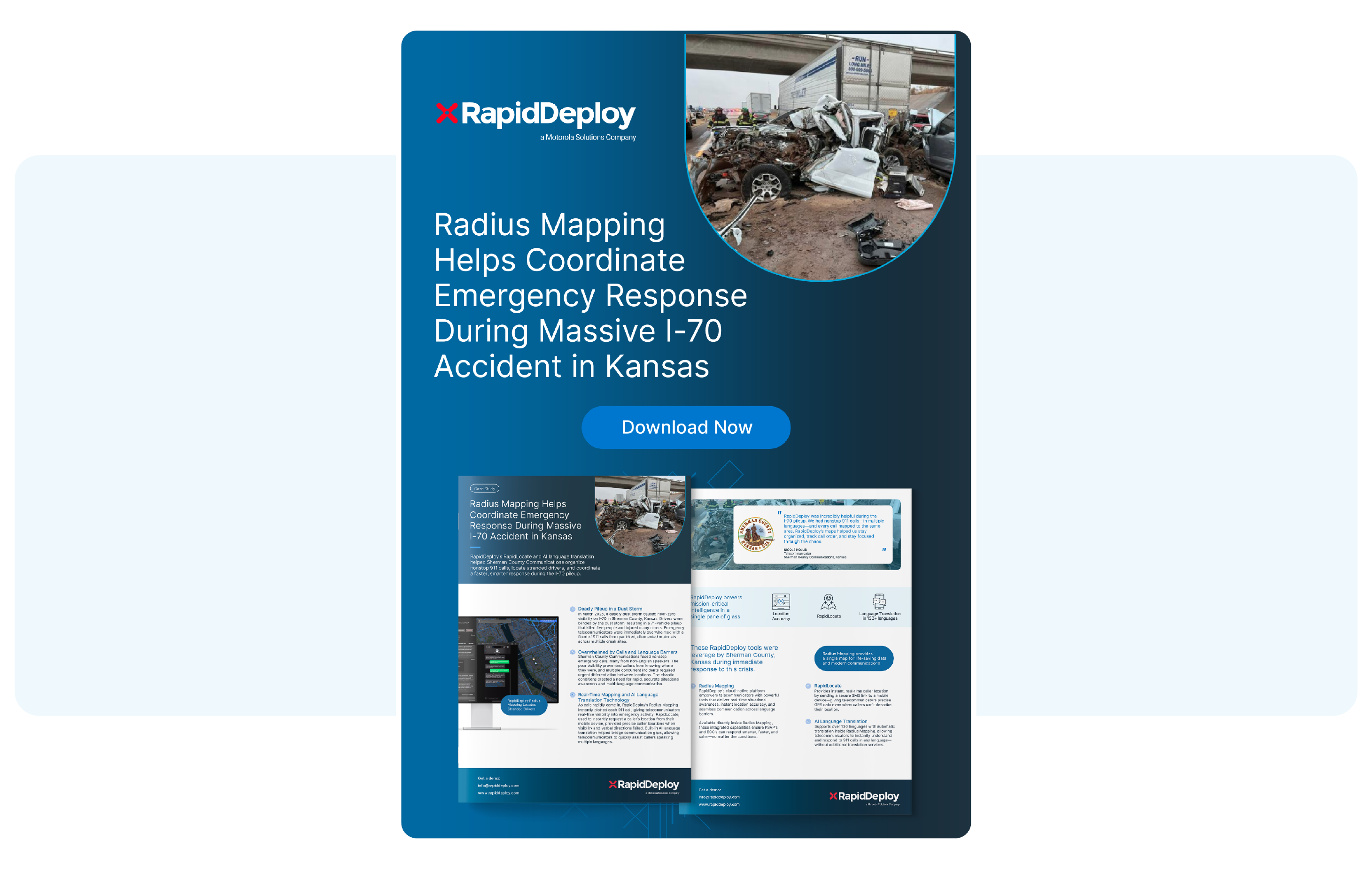
On March 15, 2025, an unexpected dust storm swept across Sherman County, Kansas, creating zero-visibility conditions on I-70, a major highway extending just over 424 miles from the Colorado border to the Missouri border. In an instant, the highway was thrown into chaos. Completely blinded by the dust, the drivers on I-70 collided with one another, resulting in a fatal 70+ vehicle pileup and leaving drivers stranded, disoriented, and in immediate danger as cars continued to collide into each other.
The Sherman County Communications team was immediately flooded with incoming emergency calls. The calls that came in needed to be managed efficiently and with care, however, many of the callers couldn’t describe their location, and several spoke different languages. To add onto the confusion and complexity, the dust storm had caused multiple crash sites, requiring responders to have very specific and exact location details in order to respond to the correct crash location.
To coordinate a timely and effective response, the telecommunicators from Sherman County turned to RapidDeploy’s Radius Mapping platform.
As calls poured in, three features within the Radius Mapping platform became critical:
Together, these features provided real-time visibility, location accuracy, and the communication clarity needed to navigate this complex, large-scale emergency. Telecommunicators were able to organize incoming calls, track the order of incidents, and coordinate response teams quickly and confidently.
For a closer look at how Sherman County Communications used Radius Mapping during this crisis, check out the full story.
For a behind-the-scenes look, watch our exclusive video featuring Sherman County telecommunicators Crissy Livengood-Ridnour and Darcy Holmes as they share what it took to respond in the face of chaos.
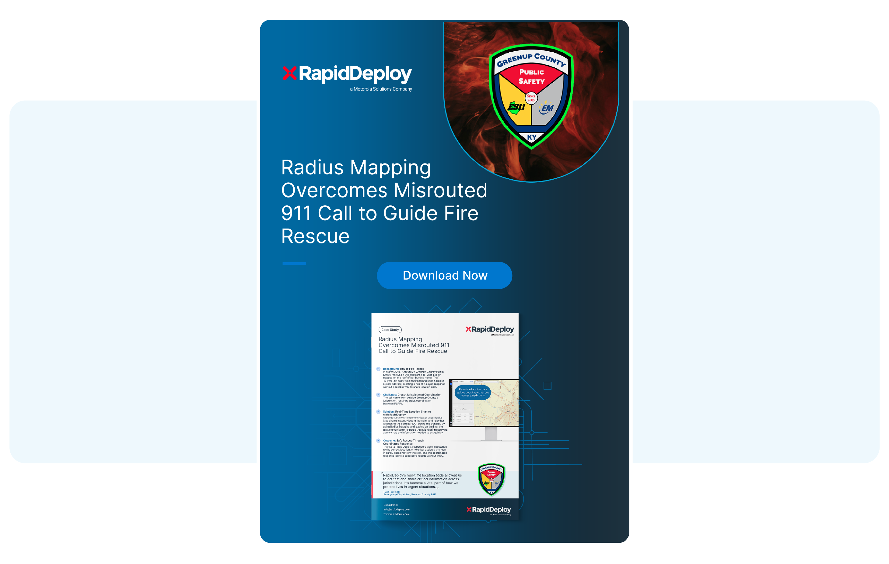
The accident on I-70 isn’t the only proof of Radius Mapping’s capabilities. In Kentucky, a 911 call was received from a 15-year-old girl who was trapped on the roof of her burning home. She was confused and panicked, causing her to be unable to provide a clear address. To make matters more challenging, the call was incorrectly routed to Greenup County Public Safety.
Despite the call coming in from outside of their jurisdiction, Greenup County quickly launched the Radius Mapping platform, which provided them:
With the help of Radius Mapping and quick thinking telecommunicators, the caller was located and safely rescued without sustaining any injuries.
To read more about how Greenup County utilized Radius Mapping during this emergency response, download the case study.
Morgan County 911 was the first PSAP in the state of Indiana to upgrade their emergency response technology with Radius Mapping. Within the first eight hours of implementing our technology, they successfully apprehended a suspect in under 10 minutes.
Watch the video to see how Radius Mapping reshaped emergency response for Morgan County 911 and why it’s earned their full approval.
From a massive dust storm on I-70 to a harrowing house fire in Kentucky, and even in the daily operations of teams like Morgan County 911, these stories are a powerful reminder that emergencies unfold fast—and responders need tools that move even faster.
Next generational 911 platforms like Radius Mapping help to locate callers who can’t describe where they are, overcome language barriers, and enable seamless coordination across agencies. This type of technology empowers telecommunicators to act with clarity, precision, and speed that helps turn uncertainty into direction and hesitation into decisive action. With the right support behind the screen, telecommunicators are better equipped to navigate the unexpected and protect their communities with confidence.
Radius Mapping has become a valuable tool in everyday emergency response. With support from RapidDeploy’s platform, telecommunicators can respond faster and with clearer information—helping them do what they do best: keep people safe.
Download the case studies to dive deeper into how agencies across the country are using Radius Mapping in the field.
Watch the video recaps to hear directly from the telecommunicators behind these life-saving responses.
Do you know a colleague or friend who has shown bravery on the frontlines? We welcome you to submit a Save Story to celebrate and honor your colleagues!
For more stories like this one and to learn about how RapidDeploy makes a difference in public safety, check out our save stories in action.


